Extensive field surveys were performed during the summer and autumn 2018 in order to complete existing biological field data for mapping of marine conservation values in the marine spatial planning area of the Baltic Proper.
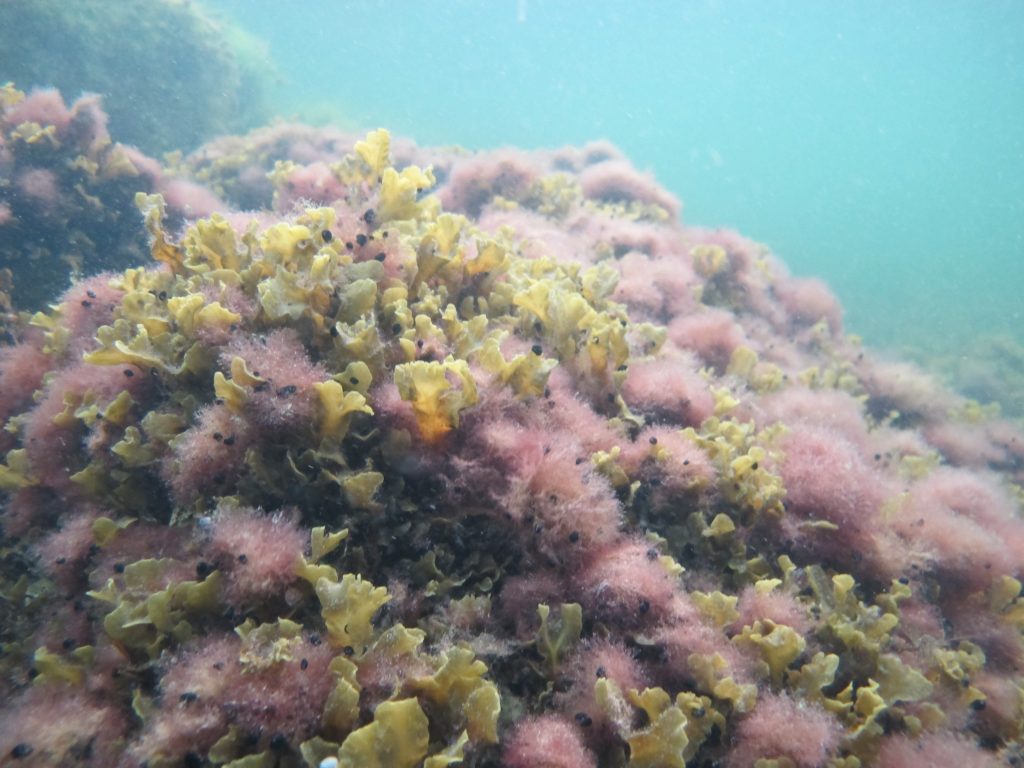
Bladderwrack and Ceramium, Gotland County 2018. Photo by Martin Isaeus.
AquaBiota performed extensive field surveys in large parts of the Swedish marine spatial planning area, the Baltic Proper (includes the Swedish parts of the Baltic Proper, including the Swedish EEZ) from June until the end of september 2018. The aim was to complete existing marine biological data for the modelling of benthic conservation values in the Swedish marine spatial planning area of the Baltic Proper as well as the coastal areas in to the coastline. The work was performed within NMK a program for national marine mapping in Sweden. The surveys were performed in the counties of Stockholm, Södermanland, Östergötland, Gotland and Kalmar and methods used were Van Veen-grabs (small Van Veen) for infauna and dropvideo and snorkeling for epibenthos. In Kalmar extra detailed surveys were performed in order to collect data for detailed mapping on county level. In total 260 stations were surveyed with Van Veen-grab I Stockholm, Södermanland and Östergötland counties and 1000 stations with a combination dropvideo and grab (grab was performed in stations were it was possible) were surveyed in Gotland and Kalmar counties (200 in Gotland county and 800 in Kalmar county). In Kalmar, snorkeling was also performed in areas that were too shallow to visit by boat.
Collected data will be used in the work with modelling maps of benthic conservation values in the Swedish marine spatial planning area of the Baltic Proper which will be performed during the winter 2018/2019.
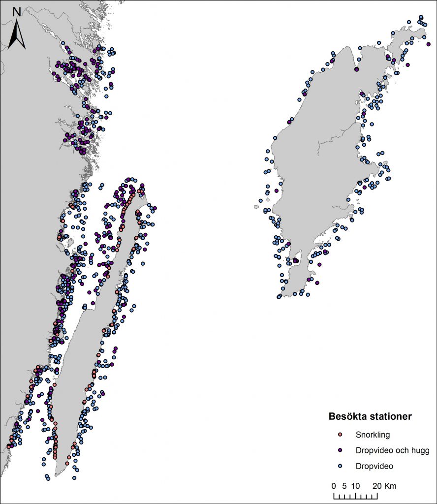
1000 stations were surveyed with drop video and grab in Kalmar and Gotland counties. Grabs were performed in all stations where this was possible. Snorkeling was also performed in 100 stations in Kalmar County.
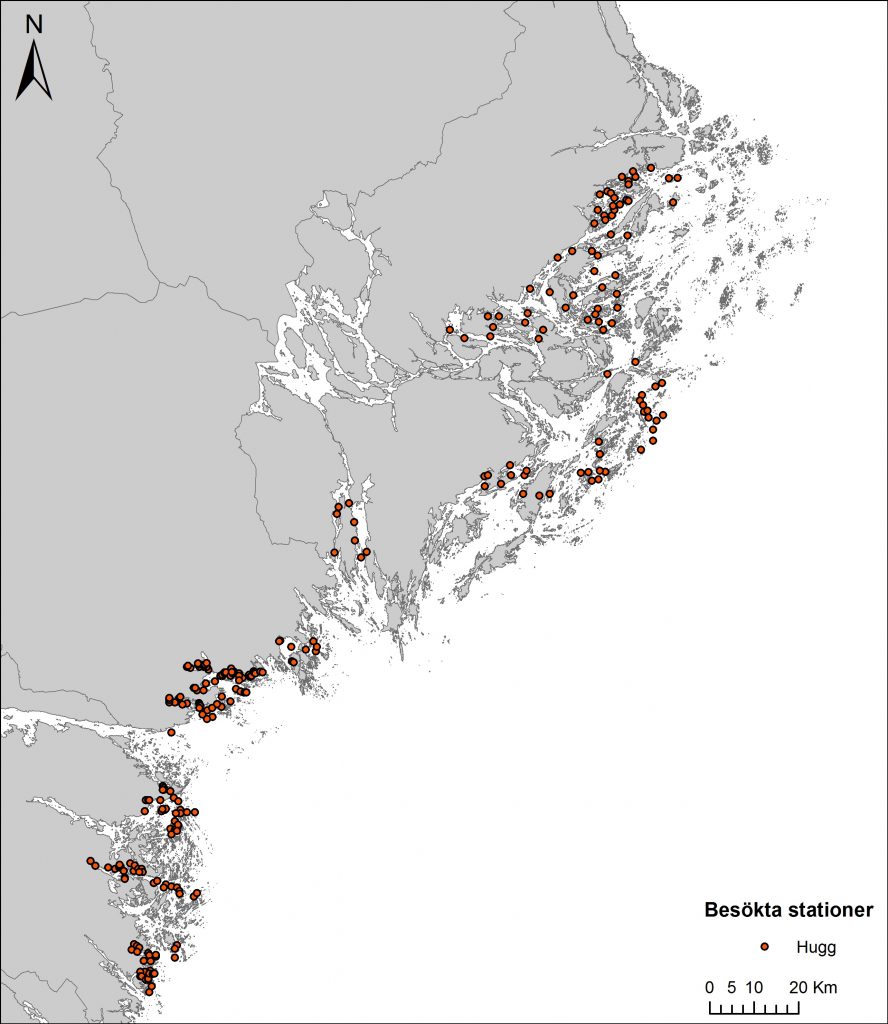
In Stockholm, Södermanland och Östergötland counties, 260 stations were surveyed by grab.